
A residential land survey is a way to measure your property. A licensed land surveyor visits your land, takes measurements, and creates an official map showing exactly where your property begins and ends. This map is a legal document. It can be used when buying a home, building something new, or solving a problem with a neighbor.
If you have ever asked yourself, “Where exactly does my land end?”, a residential land survey gives you the answer.
What Does a Residential Land Survey Include?
A residential land survey does more than draw lines on paper. Here is what a licensed surveyor measures and records during the process:
- Property boundary lines — the legal edges of your land, based on your deed and public records
- Corner monuments — small markers, usually iron pins or pipes, placed at the corners of your property
- Structures on your land — the position of your home, garage, driveway, fence, and other features compared to your boundary lines
- Encroachments — anything that crosses a property line, like a neighbor’s shed sitting on your side of the land
- Easements — rights that allow others to use part of your land, such as a path for utility workers
- Setback lines — the minimum space your structures must keep from your property lines, as required by local rules
At the end of the survey, you receive a survey plat. This is a signed, scaled drawing that shows everything the surveyor found. It is a legal record that can be used for buying or selling property, getting a building permit, or settling a dispute.
When Do You Need a Residential Land Survey?
Not every homeowner needs a survey right away. But there are common situations where getting one is a smart decision.
Buying or Selling a Home
Before you buy a home or piece of land, a residential land survey tells you exactly what you are getting. An old survey may no longer be accurate. New structures may have been built, corner markers may have moved, or zoning rules may have changed. If the existing survey is more than 10 years old, it is a good idea to get a new one before closing.
Building Something New
Planning to add a room, build a deck, or put up a storage shed? You need to know where your property lines are first. Local rules require that buildings stay a set distance from those lines. If you build in the wrong spot, you could face fines or be required to tear the structure down. A residential land survey shows you exactly where you can build.
Getting a Home Loan or Refinancing
Many banks and lenders ask for a current land survey before approving a home loan or a refinance. This is especially common for larger or rural properties. The survey confirms that the property matches what is described in the loan documents. If your lender asks for one, it is a normal part of the process.
Dividing Your Land
If you want to split your property, whether to sell part of it or pass it on to a family member, a residential land survey must happen first. No official land division can take place without a survey that clearly shows the boundaries of each new piece of land.
Checking Your Flood Zone Status
If your lender or a FEMA map has placed your property in a flood zone, a licensed surveyor can help. They can measure your home’s elevation and produce an Elevation Certificate. This document is required by the National Flood Insurance Program to calculate your flood insurance rate. In many cases, the results show that your home sits higher than the flood map suggested, which can lower your insurance bill.
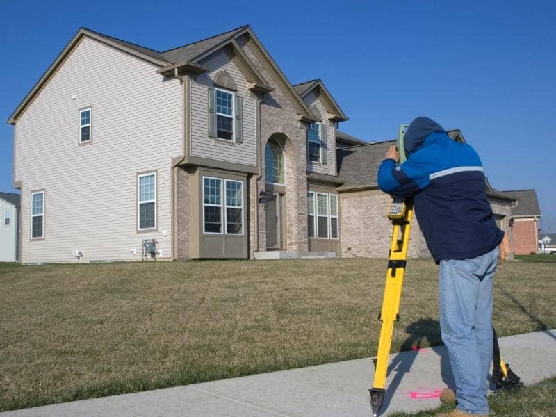
How Does a Residential Land Survey Work?
The process is straightforward and happens in three steps.
- Research — The surveyor reviews your deed, tax maps, old surveys, and public records before setting foot on your property. This step helps them understand what the legal description of your land says.
- Fieldwork — A survey crew visits your property. They look for existing corner markers, take measurements, and record the locations of your home and other structures.
- Drafting — Back in the office, the surveyor puts everything together. They check the field measurements against your legal description, note any issues, and prepare the final signed survey plat.
How Much Does a Residential Land Survey Cost?
The cost depends on a few things. Larger properties cost more because they take longer to measure. Land with an unusual shape or thick vegetation also adds time and expense. Having clear, up-to-date records available can help keep costs down.
A standard residential land survey in the United States typically costs between $376 and $745. More detailed surveys for larger or complex properties can range from $1,000 to $2,500 or more.
Always ask for a written estimate before the work begins. It is also a good idea to ask whether any unexpected conditions in the field could increase the cost.
Who Can Do a Residential Land Survey?
Only a licensed professional land surveyor is allowed to perform and certify a residential land survey. In Alabama, surveyors are licensed by the Alabama State Board of Licensure for Professional Engineers and Land Surveyors, which has been overseeing the profession since 1935.
When looking for a surveyor, here are a few things to check:
- Make sure their license is current and valid in Alabama
- Look for someone with experience in your county
- Ask for a written contract that explains what is included
- Choose someone who knows the local zoning and subdivision rules in your area