
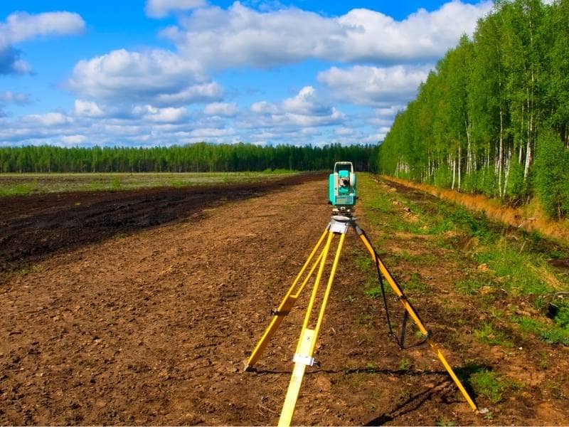
Land Surveying Is Playing a Larger Role as New Housing Pushes Into Former Timberland
Builders are running out of land near cities. So they’re looking further out, and former timberland is becoming a real option. These properties are big, often cheaper than developed land, and sitting in areas where people actually want to live. But old timber land wasn’t built for houses. The ground has its own history, and that history doesn’t just go away when a new owner shows up. That’s why land surveying matters so much before any planning gets started.
Why Former Timberland Often Contains Features That Do Not Appear on Modern Development Plans
Old timber land carries a lot of history. Logging roads cut through it for years. Fence lines went up to separate land uses. Trails formed from equipment and people moving through the same paths over and over. Old water crossings, cleared areas, and camp spots all leave marks that a county map or aerial photo won’t show.
When a builder buys one of these tracts, those features are still sitting there. Some of them matter more than people expect. An old logging road right where a street needs to go can shift the whole plan. A fence line sitting a few feet off the real boundary can slow down the title process. Land surveying finds these things before the design team locks anything in. That way, the plan works off what’s actually on the ground, not just what old paperwork says.
How Land Surveying Helps Builders Understand Irregular Tract Shapes Created by Past Land Divisions
Timber tracts weren’t split up with neighborhoods in mind. Most of the time, they got divided for simple reasons. Settling an estate. Carving out a hunting lot. Separating farmland from timber ground. Those splits created odd shapes, long narrow strips, angled edges, tracts that follow creek beds or ridge lines instead of straight lines.
Fitting a subdivision into a shape like that takes real work. Builders need to know where the boundary actually runs and how the shape affects where lots can go. Land surveying gives them that information. Without it, a layout that looks fine on paper can fall apart when it meets the real property lines. Surveyors locate the corners on the ground, work through the recorded descriptions, and hand the team something solid to design from.
Why Access Routes Used for Forestry Operations Can Influence Future Neighborhood Layouts
Timber operations need roads. Not paved ones, just paths that heavy equipment can get through. Those roads go where the land allows, following the easiest route through rough ground. When a timber tract turns into a housing project, those old roads often become the starting point for streets, driveways, and utility lines, because the ground is already cleared along those paths.
That can save money on grading. But it also shapes the layout in ways that weren’t planned. Land surveying maps out exactly where those roads sit. That lets engineers decide what stays, what moves, and what gets built from scratch. Getting those exact locations right affects street grades, where utility lines run, and how the main entrance lines up with the road outside the property.
How Land Surveying Supports the Transition From Large Acreage Holdings to Smaller Residential Lots
Turning a 200-acre timber tract into 80 home sites is a big job. Each new lot has to meet local size rules, connect to streets and utilities, and be recorded in a way that can be legally sold. That whole process starts with good survey work on the original tract.
Land surveying builds the base that makes lot creation possible. Surveyors find the full boundary, spot any easements already on the property, and help the team lay out lots that meet local rules. Here’s what that process usually covers before a single lot gets recorded:
- Confirming the full boundary using old recorded documents and corners found on the ground
- Finding existing easements and rights-of-way that cut into usable land
- Setting reference points that tie the new lot layout to recorded coordinates
- Working with engineers on street and utility placement before the final plat gets drawn
Skipping any of those steps causes problems later. And those problems usually show up at the worst possible time.
Why Land Surveying Is Becoming More Important Where Residential Growth Meets Long-Held Family Property
A lot of timber land never went through a formal sale. It passed from parents to kids, sometimes through a will, sometimes through informal family agreements that worked fine for years. The boundary descriptions in old records were written for a different time. Some reference trees that are gone now or landmarks that don’t exist anymore. Multiple family members might own shares of the same tract without ever officially working it out.
When a property like that hits the housing market, it needs a current survey before anything else moves forward. Buyers, builders, and title companies all need to know the boundaries are right and ownership is clear. Surveyors work through the old records, sort out conflicts where possible, and produce documents that show what’s on the ground today. For properties that have been in the same family for generations, that updated survey work is usually the first thing that makes a sale or development deal actually possible.
Frequently Asked Questions
Why are former timber properties different from regular residential lots?
Timber land is usually large, has uneven boundaries, and contains features that were never meant for housing. All of that takes more prep work before building can begin.
How does land surveying help before homes are built on former timberland?
It maps out exact boundaries, records what’s already on the site, and gives builders and engineers solid information to plan from before anything gets designed.
Can old roads and trails affect a housing project?
Yes. Old access routes and leftover site features can change where streets, utilities, and lots end up. Finding them early helps the team plan around them instead of running into them during construction.
Why do inherited timber properties sometimes need extra survey work?
Old boundary descriptions and informal ownership arrangements can leave gaps that need to be resolved before a property can be sold or developed cleanly.
Who usually asks for land surveying on former timberland?
Builders, landowners, investors, attorneys, and buyers all use land surveying when former timber properties move toward residential development.